Several times this summer, (usually on Sunday mornings), Kevin and I have run together on local trails. There are a few good trails that are very convenient to our home and those are the ones we usually run to and then run on. However, in mid-July, I discovered a new favorite trail...the Fairfax County Cross County Trail, a 40 mile maintained trail which crosses Fairfax County, beginning at the Occaquan River (where Caitlynne rows) in the South, and continuing North to the Potomac River at Great Falls Park.
The description of the CCT from the Fairfax County Park Authority's website (link is here), "The Cross County Trail is the primary multi-use north/south trail in the county, passing through woodlands and open space along much of its length. Users can experience a variety of landscapes, from remote wooded terrain to ballfields and developed parks, from wide stream valleys to rolling hills. The trail surface varies too, with parts of the trail wide, paved formal paths and others stonedust or even natural surface trails more appropriate to hikers, mountain bikers or equestrians. The trail crosses several streams and many of the county's main east-west roads. Where no off-road route is possible, the trail follows roadside trails or sidewalks. The trail has multiple points of vehicular, bicycle, and pedestrian access. There are maps of each section, available on line or through the Park Authority trails office. Interpretive and directional signs are being installed to assist users in understanding what they are observing and directing them to parking, drinking water, points of interest, etc. This facility crosses through all nine supervisory districts and the City of Fairfax and is an important recreational amenity for all citizens and visitors to Fairfax County."
And a map (the trail is in red and the link is here)...

Although we have to drive a short distance from our home to access the trail, it is worth the effort.
We have run on this trail twice this summer, each time running only a portion of the fifteen miles of the "Difficult Run Stream Valley" section of the CCT. This section (7 of 10), is the northern half of the CCT and follows the Difficult Run Stream Valley through the heart of Fairfax County before it ends on the Potomac River at Great Falls.
The map below is a very accurate route of our run on Sunday (links to similar maps can be found on the Fairfax County Park Authority website). We began our run at the trail access point on Jermantown Road (lower left corner of the map) and ran to Vale Road before turning around and running back to Oak Marr Park for a total distance of 8.5 miles.


On the portions of the trail that we have run, there are a lot of other paths that cross over or break away from the CCT and, in some spots, figuring out which way to go can be very confusing. However, the trail is pretty well marked and, if there is a question, we have learned to look ahead to try and spot a trail marker farther along the path.

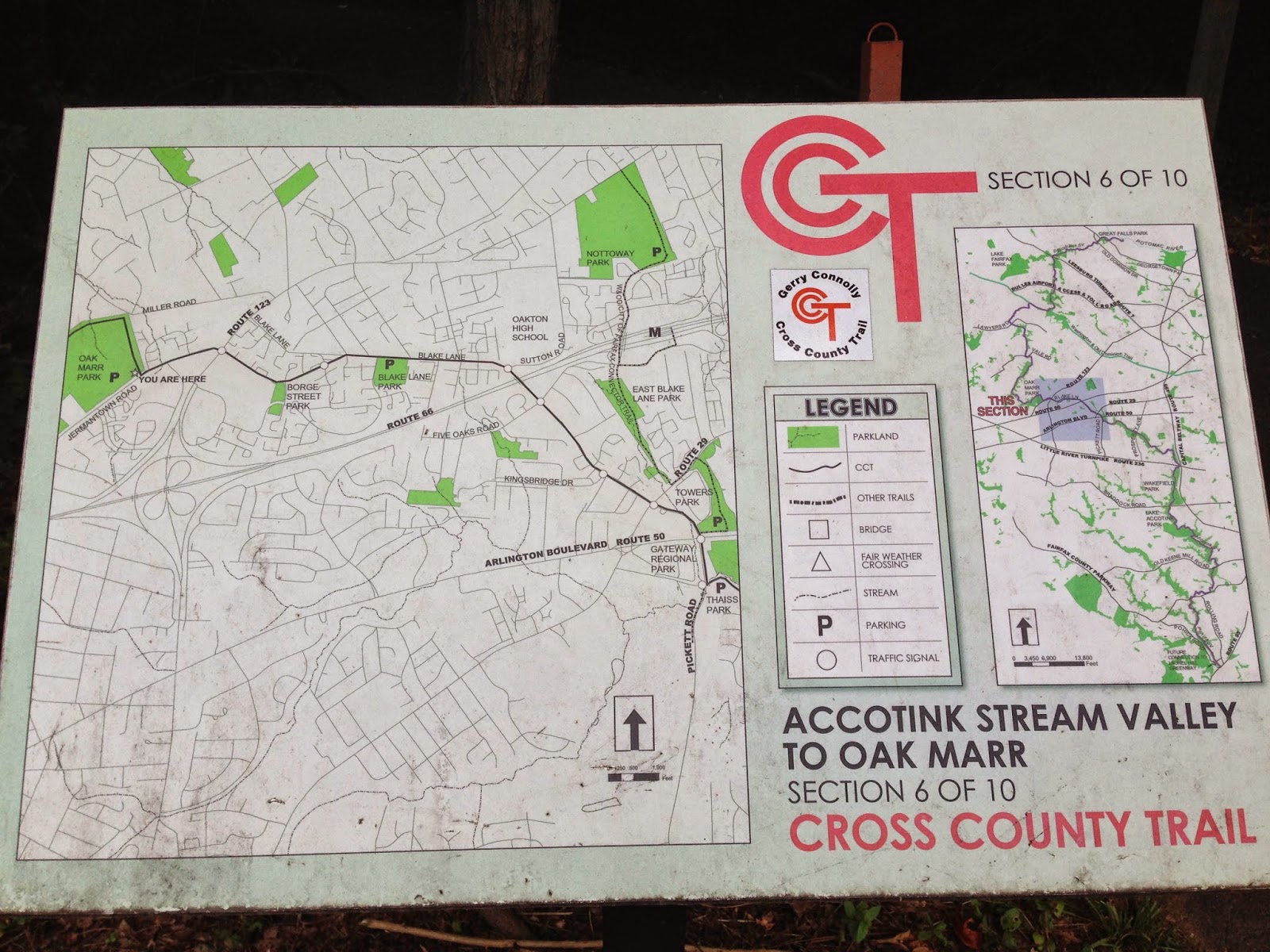
Below is a photo of the marker for Accotink Stream Valley Section 6-10 of the CCT segment that ends at Oak Marr. I have yet to find the marker for the Difficult Run Stream Valley.


I ran a little slower and enjoyed the scenery.


It is odd to be out running (and running for so long) in such a natural and peaceful setting and then realize that you are just 20 minutes away from the White House! There are a few places on the trail where you can spot homes through the woods and hear cars in the distance but, for the most part, it is very quiet.


A forest friend.


There he goes. Again.

The sign below was posted on the edge of the trail near the Oak Marr Golf Course. Since Kevin was with me and I knew my dad was in New York, I had no worries.

Have a great Tuesday!
No comments:
Post a Comment